Drone Roof Inspection in Vancouver, WA
Use drone roof imaging in Vancouver to review broad or hard-to-access commercial roofs, locate areas for hands-on inspection and document visible conditions. Aerial images can help a facility director see how roof sections relate across a broad industrial building. Our drone roof inspections in Vancouver, WA capture an overhead view of accessible roof surfaces, equipment groups, drainage patterns and visible damage. Columbia Business Center combines manufacturing, warehousing, distribution and outdoor storage beside the Columbia River. A roof overview can help organize a large property's inspection route, especially when several roof areas or access limits make a single ground view incomplete. Drone imaging shows visible surface conditions from above. It can identify areas for closer review, but it does not confirm membrane adhesion, seam strength or concealed moisture. We pair images with direct inspection where access is safe and useful. A hands-on commercial roof inspection checks seams, flashing, edges and penetrations. If the images suggest a moisture pattern, an infrared and core-cut survey can investigate selected locations. See the Roof in ContextBefore imaging, we confirm the property boundary, roof sections, safe launch and landing area, nearby people and equipment, and any site restrictions that affect flight. The flight plan should capture the roof surface and relevant details without disrupting operations. A large building near the Port of Vancouver may share its property with rail, loading, bulk storage or shipping activity. We coordinate timing and ground access with the facility contact, then capture roof views that can be related to building sections and known leak reports. Images can show membrane discoloration, standing water, visible debris, patches, equipment placement and broad changes in surface appearance. Aerial angles can make it easier to see the relationship between roof slopes, drains and low areas. They may also show an area that deserves closer inspection, such as a lifted edge or a patch with a changed outline. The images are observations of visible conditions at the time of capture. They do not establish what lies beneath a membrane or insulation layer. Vancouver's wet winter weather makes drainage routes relevant, while summer warmth can change the look of exposed surfaces and stored water. We consider recent weather and lighting when reviewing images. A dark area may reflect moisture, material variation, shade or a surface difference. We do not label it as a leak without supporting evidence. Where water entry has been reported, we compare the aerial view with an interior location and follow up at the likely seam, curb, flashing or outlet. | 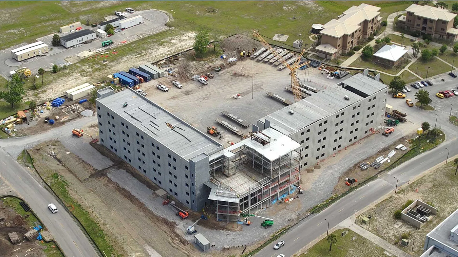 Arrange Drone Roof Imaging Request a roof assessment or call 555-555-5555.  |
Choose the Right Inspection Method
A drone is useful when the roof is broad, access is limited, or the owner needs a clear overview before selecting closer inspection points. It can cover areas that are difficult to view from the ground and help compare multiple roof sections. It is not a substitute for touching a seam, checking attachment or testing a suspect assembly. Close inspection is required to assess how a lap is bonded, whether flashing is secure and whether a membrane puncture has opened through the material.
For property managers with several buildings, consistent overhead images can provide a visual index of roof areas and equipment locations. For a Lower Grand flight, map each image to a building identifier, roof section and camera position so an owner can compare adjacent captures without confusing access limits. We label images by structure or roof section and note which areas were viewed from the air only. This prevents an overview photograph from being mistaken for a complete condition survey.
Infrared imaging addresses a different question. It looks for temperature patterns that may point to moisture, and core cuts can verify the material at chosen locations. Neither method should be confused with a drone image. We explain the basis for each observation and recommend additional testing when needed. If a close inspection identifies a defect, the owner can proceed with a repair scope or a more complete condition report that records the evidence and priorities. Broad deterioration may warrant a replacement assessment after hands-on review.
Plan for a Clear Capture
Flight conditions affect the usefulness of images. Wind, rain, low cloud, glare and shadows can limit safe operation or hide surface detail. Vancouver's winter wind and rain may call for a different capture window than a dry summer day. We schedule around weather and site activity, and we explain when a return flight would improve the record. Active operations, customer routes, vehicle traffic and sensitive equipment can also determine where the aircraft may launch and which roof areas can be viewed safely.
Some roofs have parapets, nearby trees or rooftop equipment that block a straight overhead view. We plan angled captures where possible and list any sections that could not be observed clearly. Drone imaging also depends on permissions and airspace conditions. We review the location and operating constraints before scheduling. If a flight cannot be completed, a ground-based review or access equipment may be needed to inspect the area instead.
For a large site near I-205 or the Port, timing can be coordinated with freight movement and the property manager's access plan. We request the correct building contact, reported leak locations and any known roof zones before the flight. That information helps direct the capture and connect images to a real maintenance question. The inspection should answer what is visible and where a closer review would add useful evidence.
Read Images With Care
We review images for visible changes and compare the same areas across views when available. A puddle, dark patch or discolored membrane may deserve attention, but the image alone cannot prove a leak or wet insulation. We flag the location for a hands-on check and note the observation without overstating it. Where the image shows debris at a drain, a closer visit can determine whether the outlet is blocked or whether water is collecting for another reason.
Drone imagery can reduce time spent searching across a large surface, but repair work still needs a safe roof access plan. If a defect is identified, we determine how the crew will reach it and whether materials can be moved without affecting building operations. This is relevant at Columbia Business Center, where rail and barge access, industrial users and outdoor storage shape the surrounding site. The building-specific schedule will still depend on the roof access point, equipment and work area.
We deliver an image set with labels, capture date and notes on view limitations. If a repair is recommended, the affected area is marked so the property team can connect the image to the work scope. The record can support roof budgeting, maintenance planning and later comparison. It should be stored with inspection and repair documents so a future review has context about what was seen from above and what was checked on foot.
Commercial Roofing Questions
Can drone photos confirm that insulation is wet?
No. An aerial photo shows the surface appearance, not the concealed insulation. If the roof suggests moisture, infrared patterns can help select areas for core cuts. Those openings confirm material condition at specific points. We label image observations as visible conditions and keep moisture conclusions tied to appropriate testing.
Will a drone inspect every detail on a large warehouse roof?
It can provide broad coverage and help identify areas for closer inspection, but equipment, parapets, shadows and flight limits may block some details. Aerial views do not test seams or touch flashing. We list gaps in the image record and arrange hands-on review for critical connections or suspected defects.
What makes a drone roof visit get rescheduled?
Wind, rain, low cloud, glare and unsafe ground activity can make a flight unsafe or reduce image quality. Nearby people, vehicles and equipment also affect where the aircraft can operate. We confirm the site conditions and choose another window when the roof cannot be captured clearly or safely.
How do we use the images after the flight?
Keep them with a labeled roof plan, inspection report and repair history. The images can show where equipment sits, where surface changes were observed and which areas need closer review. We note capture limitations and distinguish aerial-only observations from conditions checked directly on the roof.
Arrange Drone Roof Imaging Send the Vancouver property address, building use, roof area of concern and any access or site restrictions. We will review flight conditions and define where aerial images can help guide the next roof inspection. Request a roof assessment or call 555-555-5555.